
Ajodhya hill Purulia Tour
Ajodhya Tour video 2012
Ajodhya Hill Purulia 2012
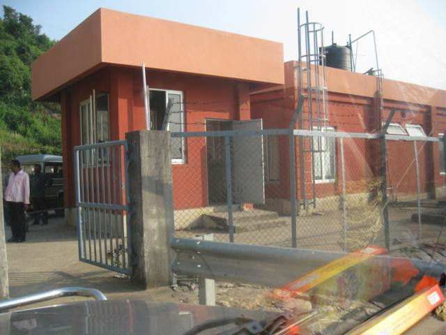
On the time of Durgapuja we had gone to Ajodhya hill in
2012. Our target was to see the Hydro project, which was under construction on
that time. It was our friendly tour of ten friends. Malay Mukharjee, Pradip
Dhabalbabu,Kabitos Chowdhury,Nazrul Islam,Jayanta Dutta, Sajal Dutta,Pantha
Banerjee, Jagannath Banerjee etc.

We reached there by 12.30 pm via Balarampur and
Baghmundi.There was another route to go there via Sirkabad but we didn’t follow
it. The place was attractive for tourism. Top of the hill ,there reside many
people and a mini market for their regular necessary commodities. We were
strange looking tea garden in between
ground to top hilly area.

Ajodhya Hills, is a small plateau with hilly
surroundings located in the Purulia district of the state West Bengal, India.
It is the easternmost part of the Chhotanagpur Plateau and extended part of
Eastern Ghats range. Highest peak of Ajodhya Hills is Chamtaburu. The nearby
populated town area is Bagmundi.
It is a
popular place for young mountaineers to learn the basic

The
area forms the lowest step of the Chota
Nagpur Plateau. The general scenario is undulating land with scattered hills.
The area around Baghmundi or Ajodhya Hill is an extended plateau.
 Distance from Purulia

1. Balarampur (268m above Mean Sea Level): 35 Km
2. Matha (260m above MSL): 46 Km
3. Sirkabad (302m above MSL): 30 Km
4. Ajodhya Hill Top (575m above MSL): 44 Km (Via Sirkabad)
5. Jhalda (304mabove MSL): 46 Km

Places to
Visit based on Balarampur-Bagmundi Route
1.
Ajodhya Hill Top: About 5 Hotels, Resorts and Lodges. 42 Km from Balarampur
Rly. Station via Matha. 24 Km from Matha Forest Range Office. 18 Km from
Bagmundi.
2.
Matha Forest Rest House: 18 Km from Balarampur Rly. Station. 10 Km from
Bagmundi.
3.
Bagmundi: 28 Km from Balarampur Rly. Station.
4.
Turga Dam and Turga Falls: 30 Km from Balarampur Rly. Station. 2 Km from
Bagmundi.
5.
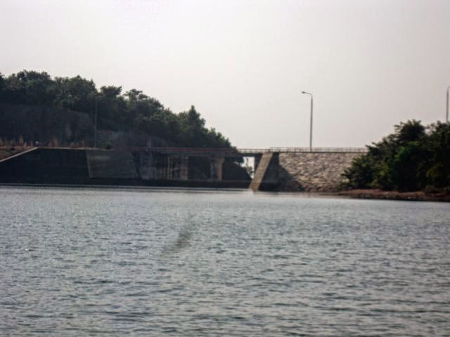
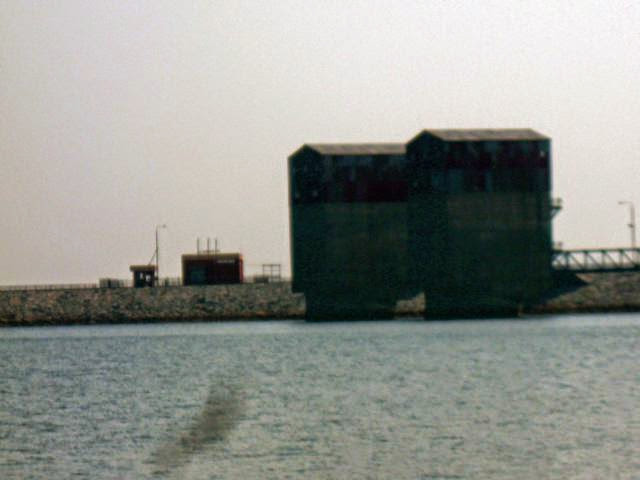
Upper Dam and Lower Dam of Purulia Pumped Storage Hydel Power Project: 36 Km
from Balarampur Rly. Station. 18 Km from Matha. 10 Km from Bagmundi.

6.
Paprakocha Dam, Gorgaburu Eco-Resot: 13 Km from Balarampur Rly. Station. 12 Km
from Matha. 23 Km from Bagmundi.
7.
Gorgaburu Eco-Resot: 13 Km from Balarampur Rly. Station. 12 Km from Matha. 23
Km from Bagmundi.
8.
Khayrabera Dam and Chamtaburu Hill: 32 Km from Balarampur Rly. Station. 14 Km
from Bagmundi. 24 Km from Matha.
9.
Machkanda Falls: 40 Km from Balarampur Rly. Station. 22 Km from Bagmundi. 32 Km
from Matha. (All via Khayrabera)
10.
Chamtaburu Hill: 32 Km from Balarampur Rly. Station. 14 Km from Bagmundi. 24 Km
from Matha.
11.
Bamni Falls: 40 Km from Balarampur Rly. Station. 22 Km from Matha. 14 Km from
Bagmundi.
12.
Durga Bera: 39 Km from Balarampur Rly. Station. 21 Km from Matha. 13 Km from
Bagmundi.

Places to
Visit from Ajodhya Hill Top (With Distance)
1.
Upper DAM (495m above MSL) and Lower Dam (300m above MSL) of Purulia Pumped
Storage Hydel Power Project: 6 Km and 9Km on same route
2.
Durga Bera (572m above MSL): 7 Km
3.
Bamni Falls (434m above MSL): 10 Km
4.
Turga Dam (284m above MSL) and Turga Falls: 18 Km
5.
Khayrabera Dam and Chamtaburu Hill: 21 Km (via forest road), 30 Km (via Bagmundi)
6.
Machkanda Falls: 18 Km
7.
Murguma Dam: 18 Km

8.
Matha: 23 Km
9.
Bagmundi (264m above Mean Sea Level ): 16 Km
10.
Pine Forest: 3 Km
11.
Mayur Pahar (605m above MSL): 2 Km
12.
Balarampur Rly. Station: 39 Km
13.
Sirkabad: 15 Km
Distance
from Jhald
1. Murguma (338m above MSL): 19 Km (Via Begunkodar)
Shimul flower in summer
2. Khairabera (304m above MSL): 32 Km (Via Bagmundi)


No comments:
Post a Comment